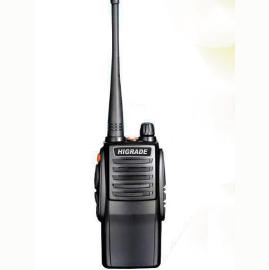
HG-UV98 Dual-Band
UHF VHF APRS Walkie talkie Positioning Track GPS Bluetooth Two Way Radio
Turn on the dynamic navigation function,
each time you receive the beacon of the rescuer, it will refresh the distance
and orientation of the rescuer.
When the search and rescue team is on the move, it will refresh the distance
and position of the rescuer in real time.
Trekking, search and rescue, patrol, expedition, event support, helicopter
aerial flight measurement and control. .
Mountains, deserts, oceans, lakes, and
air. . .
UV98 professional APRS dual-segment
positioning handbench, using standard APRS digital coding, can directly work
independently without third-party network and third-party software support,
directly send and receive positioning data through radio U/V signals, widely
used in outdoor sports, events Security, rescue and other occasions.
Host
Support U/V dual segment, A segment to
send and receive positioning data, B segment voice call.
5W, full hand frequency, fast frequency
adjustment
Support battery USB direct charging
Built-in temperature, air pressure,
voltage and other auxiliary sensors
Support user independent firmware upgrade
APRS channel
APRS channel, voice channel arbitrarily
set, A/B channel APRS, A/B channel voice
Support CH A to receive CH A transmission,
CH A to receive CH B transmission (differential rotation), CH A to receive, A
to send + B to send
Support CH B to receive CH B, CH B to
receive CH A (differential), CH B to receive, A to send + B
Support off-network use, no network,
direct mutual positioning
interface
1.8-inch color display, Chinese and
English menu
Support advanced GPS interface, beacon
list interface, real-time beacon interface, beacon record analysis interface
APRS Track
Support fixed station FIXED, sports SPORT,
2 site modes
Support complete TRACK tracker, support
intelligent, timing, PTT linkage, queue beacon
Support beacon additional information,
mileage, satellite number, voltage, temperature, air pressure, etc.
Support mileage calculation, support
accumulated mileage or automatically clear 0
Support for automatic icons (TRACK smart
mode)
Bluetooth
Built-in latest 2.0+4.0 dual-mode
Bluetooth, compatible with Android, Apple
Support Bluetooth output KISS hex, UI,
GPWPL, KISS ASC, GS232B and other protocols
Support Bluetooth output GPS data
(GPRMC+GPGGA), support mixed output
Support Bluetooth KISS data bidirectional
transparent transmission
Support streaming cloud, APRSdroid, LOCUS,
Ovi and other APP
Support wireless Bluetooth setting
parameters
APRS relay
Support full DIGI relay function, support
custom relay name
Support relay channel A\B arbitrary
forwarding
Support relay remote turn-off function
GPS/Beidou
Built-in high-performance
GPS\Beidou\GLONASS multi-mode hybrid positioning engine
APRS algorithm
Built-in advanced CMX hardware programming
algorithm
Built-in 8-level digital level adjuster
(both transmitting and receiving)
data analysis
Built-in large-capacity data storage, 100
beacon storage, viewing, intelligent sorting
Built-in advanced algorithm to support
rich data analysis
Support heading, north position, relative
motion position calculation
Support Maidenhead grid positioning system
Supports trigonometric calculations such
as APRS distance, horizontal angle, and elevation angle
Support automatic tracking control of
G5500 aircraft, ships, etc.
Remotely
Remote control peripheral module sensor
input and relay telemetry control module
software
Companion PC setup software (Chinese,
English) (requires .NET 4.0)
Professional APRS
dual stage console!
The handset itself
has dual-mode Bluetooth built-in. The optional external Bluetooth can be
plugged into the PC and can be used with the handset's built-in Bluetooth,
wireless connection, wireless settings or PC communication.
Updated 20190212C
firmware version, support dynamic navigation
When the dynamic
navigation function is enabled, each time a beacon for help is received, the
distance and direction to the helper will be refreshed once.
, When the search
and rescue team is marching, it will refresh the distance and position with the
person asking for help in real time
Hiking, search and
rescue, patrol, adventure, event support, helicopter aerial flight measurement
and control. .
Mountain, desert,
ocean, lake, aerial. . .
common problem:
Q: How far is this
handstand?
Answer: Urban
environment 1-3KM, open area lake 1-8KM, standing on the space station, the
whole of China
Q: Can it
communicate with other brands of hand or car platforms?
Answer: 1. As long
as the frequency is the same, the voice can communicate in a certain range.
2.The positioning should be the same with APRS function.
Q: Is it
waterproof?
Answer: It is
simple and waterproof, and can not be thrown into the water.
Q: Are there any
advanced waterproof machines?
Answer: Yes,
prepare a purse, import YAESU 2DR and the like
Q: How much power?
Answer: 5W
Q: Which mobile
APPs are supported by the UV98 handset?
Answer: Android
Liuyun, Aowei, LOCUS MAP, APRSdroid, etc.
Apple, no software
support, Apple Ovie can try
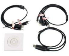
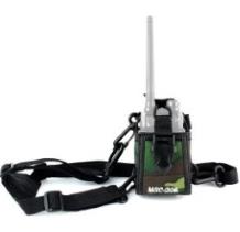
Package Included:
- 1 x Walkie Talkie
- 1 x High-Gain Antenna
- 1 x AD Adapter
- 1 x Belt Clip
- 1 x User Manual
APRS science knowledge
APRS is the abbreviation of “Automatic Packet Reporting System”, which is
an “automatic location reporting system”, which is an application of amateur
radio enthusiasts to transmit real-time location information, weather
information, telemetry information and short messages through amateur radio
stations. Most of the enthusiasts use the real-time location reporting function
of APRS, and use APRS amateur radio terminal, professional GPS, APRS Internet
gateway, APRS mobile terminal, APRS Internet webpage and other devices and
platforms to transmit and share APRS stations. , browsing, etc., to achieve the
purpose of the final application. This can be applied to outdoor activities,
fleet travel, party navigation and other aspects, and combined with APRS short
messages and other functions to expand applications.
The main function
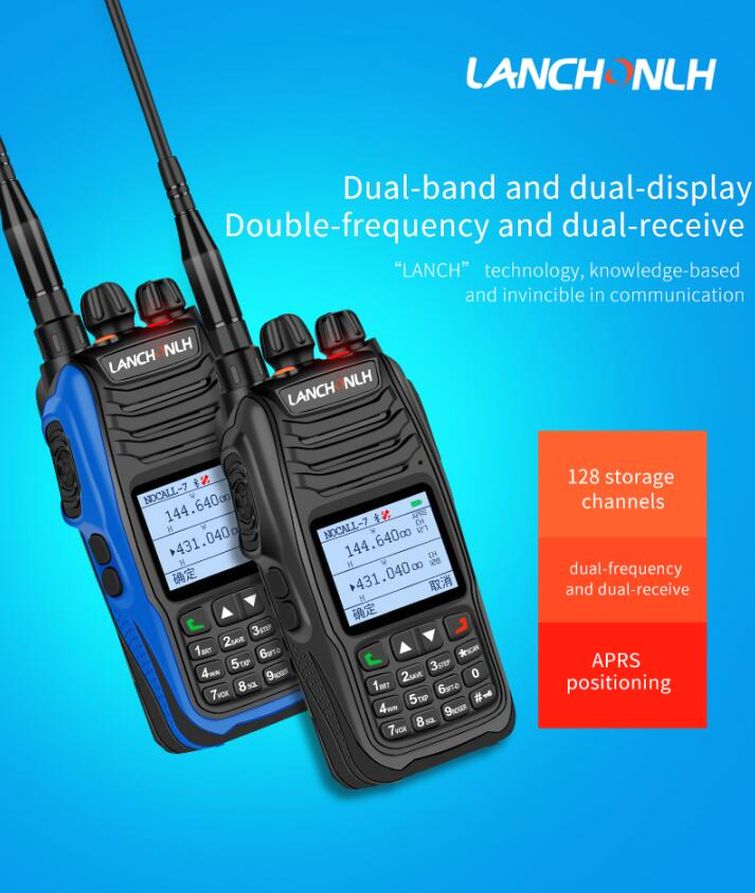
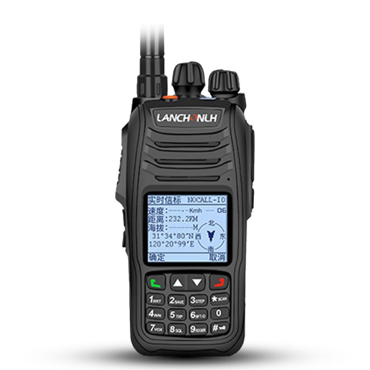
HG-UV98 transceiver performance is U/V dual-band dual display
dual-received handheld radio, transmit power 5W, full hand-frequency, channel
using APRS channel, voice channel arbitrarily set, A/B channel APRS, A/B
channel voice At the same time, support for the difference function.
HG-UV98 has a 1.8-inch color LCD display, the LCD screen has two display
modes, day and night, corresponding to white background and black background.
The display interface uses Chinese and English menus, supports advanced GPS
interface, beacon list interface, real-time beacon interface, and beacon record
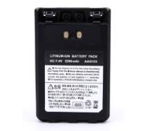
analysis interface. 2500mAH@7.2V battery, support USB direct charging, battery
voltage report, intelligent power saving mode, provide ample power supply for
GPS.
HG-UV98 supports a variety of satellite systems, GPS / Beidou / GLONASS /
automatic identification; support for complete GPS information display; support
set call sign, ID, icon, beacon additional annotation information and other
APRS parameter settings; support mileage calculation, support for accumulated
mileage Or automatically clear 0 mileage; support fixed station FIXED, sports
SPORT two site modes; support full Track tracker, support intelligent, timing,
PTT linkage, queue beacon; support automatic icon (Track smart mode); support
GPS province Electrical mode (Track PTT linkage mode, Track timing mode);
supports APRS relay function.
The GPS interface displays time, speed, altitude, longitude, latitude,
heading, date, Maidenhead grid, auxiliary sensor information, battery voltage,
temperature, air pressure, effective satellite number, and more.
HG-UV98 built-in advanced algorithm, support rich data analysis function,
support heading, north position, relative motion orientation calculation;
support Maidenhead grid positioning system; support APRS distance, horizontal
angle, elevation angle and other trigonometric function calculation; support
Automatic tracking control software for G5500 aircraft, ships, etc.
In outdoor activities, if the team uses HG-UV98, voice communication and
location sharing can be achieved among members.
This device can be used directly to build a convenient and practical
outdoor communication device with voice communication and location sharing
functions. The communication is convenient and very interesting.
HG-UV98 has built-in 2.0+4.0 dual-mode Bluetooth and is compatible with
both Android and Apple phones. Machine Bluetooth supports KISS HEX, UI, GPWPL,
KISSASC, GS232 and other protocols; supports Bluetooth KISS data bidirectional
transparent transmission; supports Bluetooth output GPWPL waypoint data, UI
text data, GPS positioning data (GPRMCGPGGA); supports Bluetooth connection
flow cloud, APRSDROID , LOCUS, Ovi and other APP.
More detailed Bluetooth connection method please refer to the tutorial:
Lianchang HG-V98 Bluetooth connection several commonly used Aprs APP method
HG-UV98 menu setting changes the tedious design of Yaesu in the past, uses
Chinese and English menu language, Chinese and English voice operation tips,
Chinese and English channel name editing and display, intuitive and convenient,
at a glance, especially suitable for enthusiasts, you don't even need to check
the manual Can operate and use this machine.
Appearance and design
After getting the HG-UV98, I made some comparisons with the Yaesu FT1D.
The appearance and feel are not lost to the machines of Yaesu. The performance
is not inferior to the FT1D.
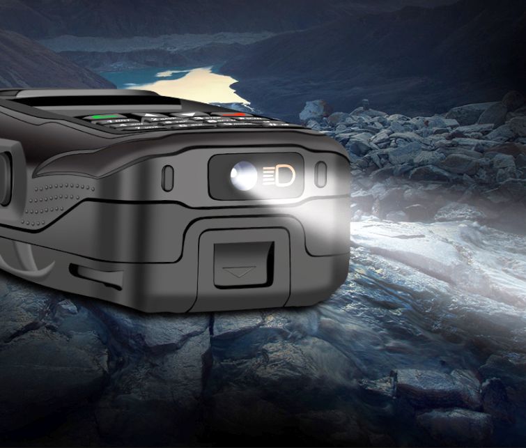
The top design of the HG-UV98 is very rich. In addition to the volume knob
and frequency/channel step knob and antenna holder with switch function, it
also has independent receiving and transmitting indicator lights and flashlight
function. The volume knob and the frequency/channel step knob are easy to
handle and the feel is very good. The brightness of the illumination LED is
relatively high, and the effect for emergency lighting in the evening is not
worse than that of the mobile phone.
The PGT area of HG-UV98 is relatively large, the stroke is long, the
hand feels comfortable, and the strength is moderate. The three buttons on the
right side of the fuselage are: 1.PTT, 2. Channel AB selection, 3.APRS
one-button transmission beacon, you can also customize the button, the function
can be selected in the writing frequency software. The left side of the
fuselage is relatively simple, and only has a headset set and a write frequency
upgrade interface.
APRS track query method
HG-UV98 uses the standard APRS code. When there is an APRS gateway nearby,
when the local beacon is received, the local track and other information will
be displayed on the APRS map.
There are currently several commonly used APRS trajectory browsing
methods:
BG6CQ server: 202.141.176.2 Automatic positioning, data viewing is
convenient, fast and convenient, a variety of quick pointing, recommended.
BA7CK APRS data server is fast and convenient, supports track playback,
direct view, and recommendation.
Digital trunking, gateway knowledge
APRS digital relay: A data relay device that is used to expand the APRS
data transmission range and is specially set up at a high place. It is
generally composed of a radio station, an antenna, a power source, and a
terminal node controller (Terminal Node Controller) having a function of
forwarding data. 'TNC') composition. The digital relay works by
receiving decoding, temporary storage, and data judgment after receiving the
APRS data in the radio wave, and identifying whether the data is required to be
forwarded. If the data is not required to be forwarded, the data will be
discarded; The data request is forwarded, and the digital relay will send the
received data after the radio channel is idle, and the digital relay's own
station call sign is added to the data for identification.
APRS Gateway: Users can send data to the APRS Internet Service Network,
and can selectively receive real-time data in the APRS Internet Service Network
by setting some filtering rules. Therefore, the user can implement APRS
communication through various terminal devices that can connect to the Internet
through a mobile phone, a tablet computer, and display the received station
information in the APRS software.
General settings
Most of the functions of this unit APRS can be operated by handheld
keyboard menu. At the same time, the supporting software and intuitive
interface provide more abundant options. It is recommended to set the native
APRS function through the supporting software.
Use the standard data cable to connect the companion APRS software to set
up the unit:
1CALL: Set the local call sign, default call sign NOCALL, numeric or
English uppercase, up to 6 digits
2SSID: Default 7, the parameter value range is 0-15.
3 site type:
SPORTS: Set this machine as a mobile station, use GPS real-time data to
send various types of beacons. Use GPS real-time latitude and longitude data,
calculate the relative distance from the other party, the north position, the
relative direction, and so on.
FIXED: Set this machine to be a fixed site, and send various types of
beacons using the fixed station latitude and longitude. Use the fixed station
latitude and longitude to calculate the relative distance to the other party,
the north position, the relative direction, and so on.
4GPS switch: ON/OFF, if used at a fixed location, you can choose OFF to
save energy.
1 Intelligent mode: When the GPS is positioned, the beacon is
automatically transmitted according to the heading and speed.
2 Manual mode: When the GPS is positioned, each time the PTT button of the
hand is pressed, when it is released, it automatically follows the beacon.
3 Timing mode: When the GPS is positioned, the beacon is automatically
transmitted according to the set time.
4 Queue mode: Launch according to the set time and time in 1 minute.
5GPS power saving function: When manually pressed, or when the time
arrives, the GPS will be automatically turned on, the GPS will start hot,
locate within a few seconds, then launch, and turn off the GPS again. Note:
Only manual mode or timing mode is active.
6PATH1, PATH2: Requires the number of relay forwarding and forwarding
names of WIDE1 or WIDE2. The default setting is: WIDE1-1, WIDE2-0, which means
that the relay named WIDE1 is forwarded once, and WIDE2 forwarding is not
required.
7MIC-E: The beacon data is compressed and transmitted, which effectively
shortens the transmission time, reduces the probability of data being
interfered by other signals in the air, and improves the decoding success rate
of the receiver.
8PTT delay: Before the signal is transmitted, the PTT trigger delay. When
the other party's SQL response is slow, the PTT delay parameter can be
increased.
9 icon 1:
! indicates the data type character, fixed length 1 word, generally do not
need to be changed. For modifications, refer to the APRS protocol manual.
/ Indicates the icon set, generally do not need to be changed. For
modifications, refer to the APRS protocol manual.
> Indicates the icon style displayed on the server map, fixed length 1
word, refer to the 'APRS Icon Set' to change.
10 automatic icon 2:
Three parameters: wait time, 2nd icon set, and 2nd icon.
180: waiting time, in seconds
/: indicates the second icon set
P: indicates the second icon
In the smart mode, when the rest time reaches the set waiting time, the
second icon is automatically converted.
11 Custom information: English up to 60 words, Chinese up to 20 words.
12 beacon options:
Mileage: The mobile station beacon contains the automatically calculated
mileage.
Satellite: The mobile station beacon contains the number of valid
satellites.
Air pressure: The auxiliary air pressure sensor data is included in the
mobile station and fixed station beacon.
Voltage: The battery voltage sensor data is included in the mobile station
and fixed station beacons.
Temperature: The auxiliary station's beacon contains the auxiliary
temperature sensor data.
For more supporting software settings, please refer to the supplied
instruction manual.
Firmware upgrade
The machine does not provide firmware updates from time to time. You only
need to go to the official website to download the firmware update package. The
data cable is connected to the PC and the walkie-talkie headset. Open the APRS
firmware and click Upgrade.
APRS application in outdoor activities
In recent years, the APRS system has been widely used in amateur radio
enthusiasts and has shown unique advantages in applications such as outdoor
emergency rescue.
In outdoor activities such as outdoor adventures and outdoor emergency
rescues, organizers and commanders need to keep track of the specific location
of personnel and vehicles. This not only ensures the safety of personnel, but
also informs appropriate personnel and vehicles in real time when necessary.
The right task to improve the overall efficiency of action. In this process,
the location tracking function of the APRS system is indispensable.
Taking outdoor emergency rescue as an example, you can easily understand
the importance of the APRS system and its operation mode: it is especially
important to grasp the real-time position of teammates in areas such as
mountainous areas where there is no communication network coverage and complex
terrain. However, at this time, the players cannot use the mobile phone
software to transmit coordinate information, and it is difficult to accurately
describe the location of the location using the radio voice communication
device. At this time, if the device is frequently used for voice communication,
on the one hand, the workload will be increased. On the other hand, occupying
the communication frequency for a long time will also affect the reporting
situation of other teams. In addition, frequent calls can deplete the valuable
power of the handstand too much.
The best choice at this time is to use the APRS system to control the
position of the players. When the APRS amateur station used by each emergency
rescue team has the same data input/output interface as the GPS device and has
the same transmission communication protocol, the APRS amateur station and the
GPS device seem to have no associated devices. data transmission. Only through
the appropriate matching link, the APRS station can input the received other
team coordinate information into the GPS device as a waypoint output, and
display and navigate on its screen.
Amateur radio also reports its real-time data to the command by radio
waves. The data includes the latitude and longitude of the team's real-time
location, altitude, team movement speed, direction, and unique call sign
representing the owner's identity. The data is decoded. Displayed on the
computer screen of the command. If the command can connect to the Internet, you
can also forward the received data stream to the Internet, and you can also
observe the entire group's movement track in real time through the computer.
Q: How many hours
can a single battery work in the wild?
Answer: Interval
firing, 5-8 hours, depending on the intensity of trial use
Q: What is the
purpose of the optional Bluetooth?
Answer: It is not
necessary to plug it into the computer. It is used to wirelessly set the
parameters of the UV98 console through the computer or to communicate with the
computer map software.
UV98 professional
APRS dual-segment positioning handstand, using standard APRS digital coding,
can work independently without third-party network and third-party software
support, directly send and receive positioning data to and from each other
through radio U / V signals, and is widely used in outdoor sports and events
Security, rescue and other occasions.


| 

 Chinese
  Français
 Deutsch
 English
  Español
 Português
 اللغة العربية


 Bank Transfer